
Digital Newsletter
Each week our editor Phil Alsop rounds up the most popular articles, videos and expert opinions. We compile this into a Digital Newsletter and send it straight to your inbox every week.
Digital Magazines
We'll let you know each time a new edition of Digitalisation World is released so that you're always kept up-to-date with the latest and greatest news and press releases.
Video Magazines
The Digitalisation World Video magazine contains the latest Zoom interviews with experts in the industry.
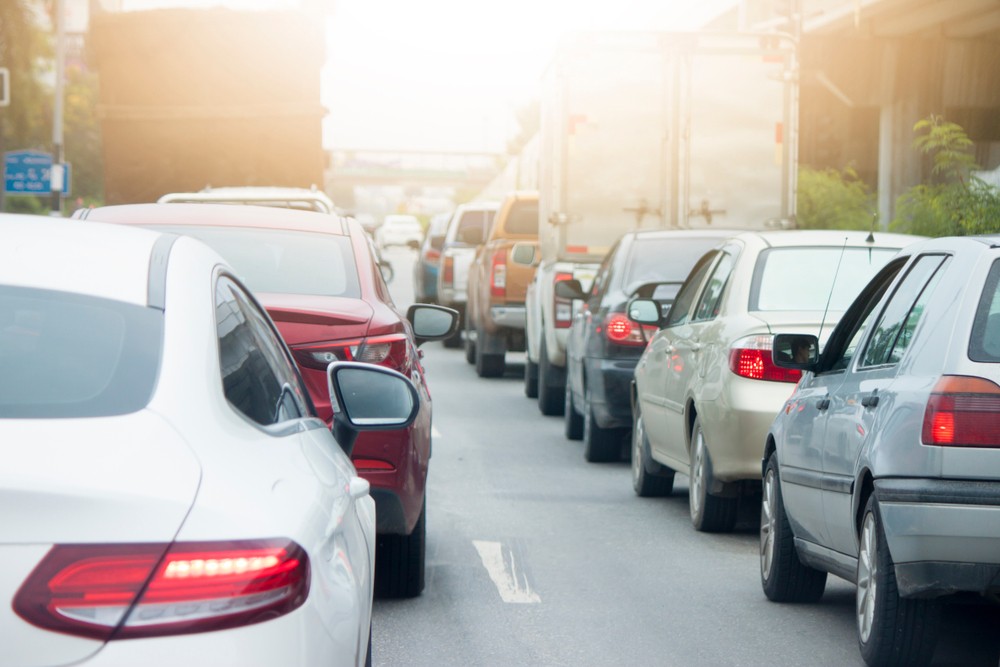
When people imagine the future of driving, they usually put artificial intelligence (AI) behind the wheel. Fully-autonomous, electric vehicles will ferry consumers to and from their chosen destination, with smart AI assistants that provide real-time travel updates and recommendations. Yet the application of AI in tomorrow’s vehicles isn’t limited to automating the task of driving. It has a much more subtle – but no less important – role in ensuring the safe and successful navigation of drivers and their passengers.
AI helps to make products and procedures more efficient, but it also handles intricate tasks that can’t be easily managed by humans. Today, navigation has become so highly complex that only AI can find the optimal route. Powerful, accurate maps can be created by deep learning models, able to process masses of images no human cartographer could ever manage.
However, car manufacturers face a considerable challenge in getting their solutions off the ground. When the control over navigation is taken out of the driver’s hands, there is a need to ensure that the data the AI is working with is up to code. Yet how do businesses collect the vast quantities of data required, and how do they ensure it is kept accurate and up to date? Fortunately with new modelling techniques and a crowdsourced approach to data collection, car makers can provide the fuel to enable AI-assisted driving.
Good AI needs good data
Most modern car navigation systems can leverage data and the Internet of Things to alert for travel disruptions and readjust the journey route accordingly. Yet few are complex enough to anticipate how the traffic situation will change during the travel time on any possible route. In the European road network alone, a hundred quadrillion routes are theoretically possible. Yet, machine learning allows for this through a process called dynamic routing, which helps AI navigation systems to actually predict how traffic will change and how the journey will be disrupted.
With dynamic routing, drivers and automated vehicles can drive with foresight. However, building the AI models needed isn’t the hard part. It’s data that makes the difference. For instance at TomTom, immense quantities of image data depicting street views are needed to create high-definition maps. To ensure the navigation system is responsive, there’s also a need for data on the same streets under a wide variety of environmental and weather conditions. The more data there is, the more accurate the maps will be.
An enormous amount of data is required to train AI models so that they truly represent reality. The job of photographing every stretch of road in every weather and lighting condition is obviously impossible. Abstracting the process through AI, however, can help us achieve such “impossible” but vital tasks. Through the use of novel generative algorithms, it’s possible to train AI to take one image and apply different conditions to it. For example, the AI could simulate the same street at night or during a blizzard. Thus, when an AI-enabled navigation system encounters atypical conditions on the road, it can adapt rather than lock up. This is a crucial step in helping AI not only to recognise roads but also respond to them.
Increasingly, car and mapmakers also need to keep privacy and security in mind. Few data is as sensitive as customer location history, proving a challenge for those who rely on large-scale data to ensure the accuracy of their maps. Privacy-aware machine learning, made up of AI algorithms that learn from anonymised raw data, is the answer. Once trained, the models can be shared, allowing companies to continue to train and enhance the full pool of shared models with new ones.
Crowdsourced cartographers
To keep digital maps accurate and up-to-date, a key ingredient is community engagement. It’s essential for car manufacturers to develop – or seek out - navigation systems with a built-in community of people who are willing to help keep maps accurate. Whether it’s through an app or interface which allows people to contribute, drivers can share images of where reality doesn’t match what has been recorded, such as road closures or road signs. This then alerts mapmakers to check and fix the map as necessary.
The challenge of building this community, however, is consumer suspicion. As the world becomes increasingly more aware that services such as online mapping tools can often be ad-funded, customers are less likely to share their data. How can we trust these service providers to send us the quickest route when in-fact what they’re doing is sending us on a detour past one of their advertisers? That’s why car manufacturers need to seek out a navigation system that isn’t advertiser funded.
As our transport networks grow increasingly complex, accurate and responsive, and cars become more automated, AI navigation systems will become a necessity. Yet, car manufacturers and developers must ensure they have a strong data foundation first. Quality data from multiple trusted sources is the best kept secret to improving digital maps. More specifically, abstraction through AI modelling and crowdsourced maps will lessen the computing load on systems and ensure AI-assisted navigation remains safe and successful.